
Unmanned Aerial Vehicle, abbreviated as UAV in English, stands for Unmanned Aerial Vehicle. Its development process can be roughly divided into three stages.
The period from 1910 to 1950 was the early stage of drone development. The concept of drones began to emerge during World War I, initially referred to as aircraft automation, with a significantly different form from current drones and primarily used for training. During World War II, drone technology developed rapidly and major warring countries invested in research and development. At this time, drones were mainly used for military training and as targets for artillery fire.
The period from 1950 to 2000 was a rapid development stage for unmanned aerial vehicles. During the Cold War, drones began to be used for military reconnaissance missions. After the end of the Cold War, with the development of computer technology and sensor technology, the design and functionality of drones continued to improve. Military drones became increasingly powerful and replaced manned aircraft in many missions. In the late 1980s, drones entered the civilian field and numerous small drones and remote-controlled aircraft appeared.
From 2000 to the present, it is the stage of comprehensive popularization and application of unmanned aerial vehicles. The rapid development of new materials, sensors, communication, large capacity batteries, software and other technologies has given rise to a large number of unmanned aerial vehicles with different functional characteristics and styles. Their application scope has greatly expanded, covering many fields such as agricultural plant protection and disaster monitoring. With the continuous popularization of drones, countries have begun to formulate laws and regulations on drone management. China has also issued regulations on drone flight management, which clearly stipulate the flight permit, flight safety requirements, operator qualification management, and monitoring of flight activities for drones.
2、 Classification and System Composition of Drones
There are multiple classification methods for drones, with the most common being military drones and civilian drones based on their purpose.
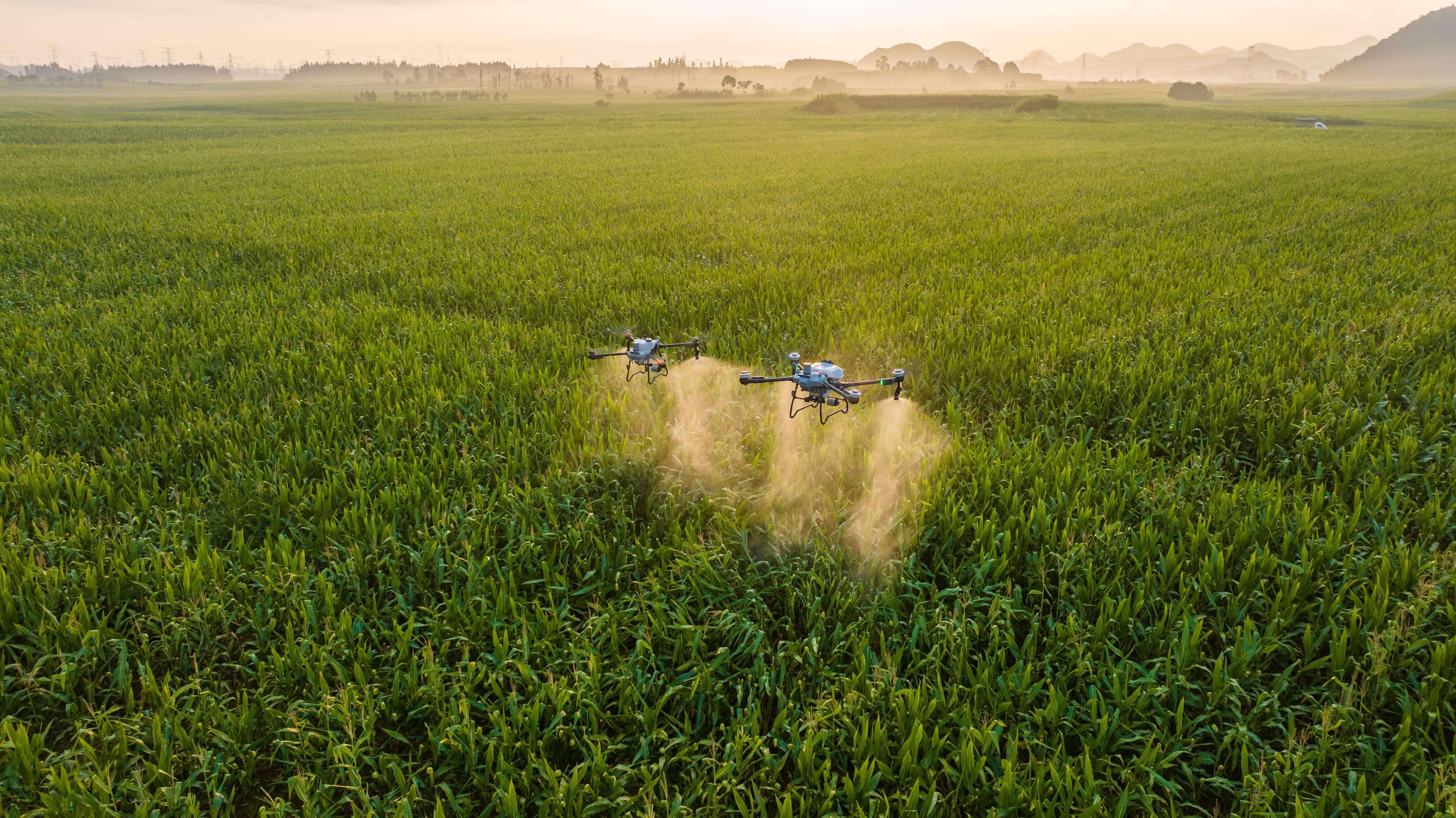
According to the flight mode, it can be divided into fixed wing unmanned aerial vehicles, rotary wing unmanned aerial vehicles, tiltrotor unmanned aerial vehicles, and flapping wing unmanned aerial vehicles. Fixed wing unmanned aerial vehicles rely on the lift generated by the wings to fly, requiring a certain takeoff and landing distance; Rotorcraft drones use rotating propellers to generate lift and can take off and land vertically, and are divided into unmanned helicopters and multi rotor drones; Tilt rotor unmanned aerial vehicles combine fixed wing and rotor design features, and can change the rotor position during flight to achieve different flight modes; Flapping wing drones simulate the flight mechanisms of birds and insects, using flapping wings to generate lift and propulsion. According to the driving mode, it can be divided into electric drones and fuel powered drones. According to the Interim Regulations on the Flight Management of Unmanned Aerial Vehicles, they can also be divided into micro, light, small, medium, and large categories, with air mass and maximum takeoff weight being the main distinguishing indicators.
The takeoff methods of drones include horizontal takeoff, catapult takeoff, and hand thrown takeoff. Horizontal takeoff is a common method adopted by fixed wing aircraft, while catapult takeoff uses catapult equipment to rapidly accelerate the fixed wing aircraft from rest to takeoff speed. Hand thrown takeoff is used for smaller and lighter fixed wing and flapping wing drones. The landing methods include vertical landing, horizontal landing, parachute landing, net interception landing, and rope interception landing.
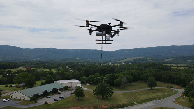
The unmanned aerial vehicle system generally includes five parts: unmanned aerial vehicle platform, flight control system, communication module, ground control station, and payload. A drone platform is an actual flying body, typically composed of a fuselage, wings, power system, and sensors. The flight control system is responsible for the flight stability and navigation of the drone, consisting of hardware and software, including sensors and control algorithms. The communication module is responsible for data transmission between drones and between drones and ground control stations, and can use multiple communication methods. The ground control station is the interface between the operator and the drone, responsible for flight monitoring, mission planning, and data reception, and can take on various forms. Payload is a device that collects environmental data and performs specific tasks, and can have different combinations of sensors depending on the application.
At present, there are two new technologies and methods for controlling drones: drone self-organizing network technology and drone specific airport technology. The drone self-organizing network technology combines Mac network technology with drones, allowing them to automatically connect and disconnect during flight, forming a dynamic network and improving the communication control range, anti-interference, and task completion capabilities of drones. The drone specific airport technology provides a centralized management environment for drones, allowing for takeoff, landing, charging, maintenance, and storage, which is beneficial for improving the operational efficiency of drones and reducing maintenance costs.
3、 The application of drones in the civilian field
Drones have penetrated almost all fields, and the following are just some common and typical application scenarios and cases.
In the field of surveying and mapping, drones were first introduced, which can quickly produce large-scale 2D and 3D maps and models, reduce field costs, shorten operation cycles, and provide accurate data support for natural resource surveys. If equipped with multispectral cameras, they can automatically and efficiently classify vegetation and water bodies.
In the field of transportation, drones are applied throughout the entire lifecycle of engineering construction. They are capable of handling application scenarios that are difficult for traditional manual inspection in bridge inspections. In emergency response to transportation infrastructure, natural disasters, and major traffic accidents, they can quickly obtain first-hand information and provide real-time feedback.
Cultural tourism is also a common application area of drones, which are equipped with laser scanners and optical cameras to capture cultural heritage up close, establish real-life 3D models, and promote digital protection of cultural heritage. For example, Hengshan Hanging Temple in Shanxi Province used drone photogrammetry to build a digital model.
In the power industry, the application of drones is becoming increasingly popular. Conventional visible light or zoom cameras can be used to capture images of power facilities in safe areas, while thermal infrared cameras can achieve round the clock inspection and discover hidden dangers. For example, DJI's M300 drone conducted power tower inspections in the western Sichuan region, avoiding the danger of manual climbing.
In the forestry field, drones can be used for forest patrols and forestry investigations, solving the problems of traditional manual patrols and fixed-point video surveillance. They are widely used in tasks such as illegal land inspection, monitoring of deforestation, and assessment of vegetation growth. They can also be applied to forest fire prevention, conducting daily patrols, issuing warnings, real-time monitoring of fires, and extinguishing fires.
In terms of environmental protection, drones equipped with visible light cameras can be used to patrol water bodies such as rivers and banks, monitor issues such as "four chaos", and drones equipped with thermal imaging cameras and multispectral cameras can be used to verify illegal activities such as illegal discharge and leakage of sewage, as well as monitor the quality of drinking water sources and atmospheric environment. Their gas sensors can also obtain more three-dimensional and comprehensive data in real time, locate abnormal data areas, and quickly find pollution sources.v